FAQ Table
Click a question below to view the answer, or browse questions to the right.
How do I use this website?
LawAtlas.org is a website that provides free and open access to legal datasets created using scientific legal mapping methods. The data may be used in a variety of ways, but essentially, they provide objective information about characteristics of laws and policies that may be significant to the public’s health.
Visitors to our site can explore the data using our interactive maps and tables to identify similarities and differences in laws and policies across locations, explore trends and changes over time, and access the full text of the laws and policies behind the data.
All the datasets on LawAtlas.org also may be downloaded as .csv files. Each dataset is accompanied by a codebook and research protocol that transparently describe the variables included in the data and the process through which the data were created.
We have instruction guides and videos to help you get started.
Who runs this website?
LawAtlas.org is maintained by the staff at the Center for Public Health Law Research at the Temple University Beasley School of Law. Learn more about our staff.
LawAtlas.org was designed by Graphicacy and built by engineers at Digital Avenues and Source Digital and Graphicacy with funding from the Robert Wood Johnson Foundation.
Who conducts the research?
The legal datasets displayed in the maps and tables on LawAtlas.org are primarily created by the Center for Public Health Law Research and our collaborators. Each dataset page includes information about who initially created the dataset and who maintains it.
If you are interested in creating a dataset or updating an existing dataset, please contact LawAtlas@temple.edu.
How are the datasets created?
The majority of the datasets on this site are created by the Center for Public Health Law Research staff or our collaborators using scientific legal mapping methods — primarily policy surveillance — to capture the detailed characteristics and nuances of laws and policies of public health significance across jurisdictions and over time.
The policy surveillance process involves a series of systematic and transparent steps that support the creation of high-quality data that may be used in research and practice. To learn more about the details of the policy surveillance process and other scientific legal mapping methods, visit our Learning Resources to access training materials and learn more about attending a training event.
What technology or tools do the researchers use to create these legal data?
The data hosted and visualized on LawAtlas.org were created using scientific legal mapping techniques facilitated by the MonQcle software platform (pronounced "monocle"). MonQcle was designed to help users create cross-sectional and longitudinal datasets linking text to locations (jurisdictions or other places) using a question-and-answer format with full pin-citations linked back to that user-provided text. The platform also provides visualization tools to support researchers as they organize, develop, update, and share their data.
MonQcle is currently available for public use for non-profit and academic researchers conducting scientific legal mapping projects, thanks to the support of the Robert Wood Johnson Foundation. Get started today by visiting MonQcle.com or contacting LawAtlas@temple.edu. Commercial entities interested in using MonQcle should contact LawAtlas@temple.edu for a subscription or licensing quote.
There are several different ways you can use our resources and tools to create your own legal data:
- DIY: Follow our learning resources and training documents on MonQcle to make your own legal dataset or contact us to talk about adopting an existing dataset to update.
- Work with us: We provide training and technical assistance to teams working on scientific legal mapping projects and can guide you through the process. We can also collaborate with you, with our researchers working alongside your team. Contact us to start the conversation.
- Work for us: Interested in joining our team? Check out our Employment Opportunities.
How often are datasets updated? I am interested in seeing more updated data on a topic.
That depends largely on funding. If there are data that you would like to see updated, please contact us — we are always keen to discuss opportunities to update data together, or help you get started with our methods to update the data directly.
Is access to the data really free?
Yes! To read the Terms of Download, please click here. To read the Creative Commons License, please click here.
What formats are available for downloading the data?
Datasets are downloadable as .csv files. The codebook and protocol documents, which provide details on how the data were created, updated, and organized, are downloaded as .pdf files.
An API is also available should you be interested in displaying the data visualizations on your own website. Please contact us for more information about the API.
Where do you find the text of the law used on the site?
We have a defined, systematic process for finding the text of the law used for each dataset. The legal text shown on our site is gathered directly from unencumbered sources, such as government or agency websites.
To learn more about that process, view Module 4: Collecting and Building the Law in our 8 Module Course, accessible from our Learning Resources.
Why is there no map or table on some of the dataset pages?
While almost all the datasets on LawAtlas.org are interactive and feature maps and tables, for a few of our datasets, we provide the data in spreadsheet format (.csv download) only. To maintain the health of our website, datasets are archived — moved to data download only — based on a few criteria:
- Minimal historic use of the data.
- The data were created or last updated more than five years ago.
- There is no funding or existing plan to update those data in the foreseeable future. Data could be updated in the future, but there is no plan at the time of the archiving decision.
What are Collections?
Collections are curated groups of datasets, most often organized by a shared topical focus. For example, the Housing Collection includes datasets in our library that capture laws and policies governing a variety of conditions related to safe, affordable, and accessible housing in the United States. The US Abortion Law Collection catalogs datasets that capture US state laws regulating abortion.
You can navigate to Collections from the main menu at the top of every page on LawAtlas.org, or by using the Collections filter when you explore our Topics library.
What is legal mapping?
Legal mapping is a set of techniques used to capture important features of laws and policies, and to identify how those laws and policies may vary across jurisdictions or institutions, and often over time.
Legal mapping takes many forms. It can be conducted using transparent scientific methods for empirical research in legal epidemiology, or it can rely on conventional legal research methods to answer important questions in public health law practice.
Scientific legal mapping activities for legal epidemiology include policy surveillance, legal assessments, and sentinel surveillance. Legal mapping activities for public health law practice include legal scans and legal profiles.
For more information about each technique, detailed instructions on the methods and how to use them to do your own research, access our Learning Resources.
What is policy surveillance?
Policy surveillance is a form of scientific legal mapping. It is the systematic collection, analysis, and dissemination of laws and policies across jurisdictions or institutions, and over time. Policy surveillance is not limited to just laws and policies made and enforced by governments, it can also include corporate and institutional policies. Policy surveillance is at the root of legal epidemiology, which is the scientific study and deployment of law as a factor in the cause, distribution, and prevention of disease and injury in a population.
Researchers conducting policy surveillance use a scientific process to produce datasets that capture the characteristics of law on a specific topic at a specific moment in time, and to track the change and progression of those laws to date, and often historically.
Along with the Centers for Disease Control and Prevention, the Public Health Law Research (PHLR) program (which was the name for the original Robert Wood Johnson Foundation-funded program that became the Center for Public Health Law Research at Temple University) formalized the process for conducting policy surveillance to support the creation of empirical legal data to facilitate health policy evaluation for public use. The process has been refined through a Delphi study of public health law researchers.
What is the difference between policy surveillance datasets, legal assessments, and sentinel surveillance?
Policy surveillance and legal assessments both produce robust data using a rigorous scientific process. Policy surveillance tracks laws over time and across multiple jurisdictions. Legal assessments track laws at one specific point in time, either across multiple jurisdictions, or in one jurisdiction.
Sentinel surveillance is a relatively new legal mapping method. It is intended to quickly capture and track emerging laws and legal innovations impacting public health. The method creates a dataset that may be the foundation for ongoing policy surveillance, allowing researchers to determine priority candidates for future scientific legal mapping in a timely manner, which ultimately supports the creation of robust legal data that can be used to evaluate emerging laws and policies. The data are produced transparently and systematically, but because of the minimal quality control methods used (there is only one coder and a supervisor who check the data), these data are not meant to be readily usable for evaluation. Instead, they are meant to provide a high-level overview of laws and policies that gives policymakers, advocates, researchers, and others a snapshot of a new or rapidly evolving legal landscape.
What is legal epidemiology, and how does it relate to policy surveillance and scientific legal mapping?
Legal epidemiology is the study of law as a factor in the cause, distribution, and prevention of disease and injury.
Policy surveillance datasets are at the heart of most legal epidemiology studies because policy surveillance turns the text of the law into rigorous, quantitative data that can be used for empirical evaluation. Learn more about legal epidemiology.
How can I learn how to do policy surveillance or another type of legal mapping?
The Center for Public Health Law Research maintains a series of training resources that teach scientific legal mapping methods. Learn more about those resources in our Learning Resources section.
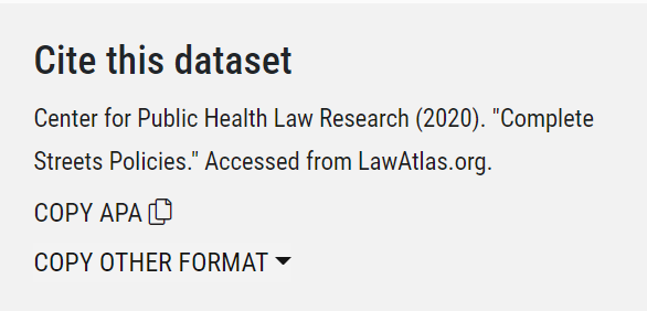
How do I cite this as a resource in my work?
The "Cite this dataset" box on each dataset page offers a one-click citation download for the dataset. We offer the following formats: APA, MLA, Bluebook, and Chicago
Generally, please cite the researcher or team identified in the lower right of the map page ("Maintained By"), and then use “Temple University Center for Public Health Law Research” in your citation as the publication source. For example: Burris, S. Syringe Distribution Laws Map. Temple University Center for Public Health Law Research. Accessed July 1, 2021.
I’m a journalist and I’d like to talk to the researcher responsible for one of the datasets. Can you help me connect with them?
Definitely! You can call Bethany Saxon, our Director of Communications, at 215-204-2134, or send her an email at bethany.saxon@temple.edu.
I‘ve found an error in the data, how do I report that?
Our data go through a detailed and rigorous quality control process, including statistical quality control measures (learn more about the quality control process), but errors do still unfortunately happen. Please contact us directly and let us know what you’ve found. One of our researchers will reach out as soon as possible about the error.
Can I be alerted when a dataset is updated?
There are a few ways to stay up to date on what’s happening with our project. The first is through our social media accounts (which are linked at the bottom of each page on this site) where we post resources and announcements when we have an updated or newly released dataset. You can also add yourself to our mailing list at the bottom of this page — we send emails for every dataset we publish or update summarizing key trends and findings.
I would like to have my legal mapping data published to LawAtlas.org. How do I do that?
If you have legal mapping data on a topic not published here, or would like to work with us to update an existing dataset, please contact LawAtlas@temple.edu. All data and documents will undergo review by Center for Public Health Law Research staff before they may be published to LawAtlas.org.
Help! My question wasn’t here.
Please reach out to us, we’re happy to help. Click on the letter icon at the bottom of the page to send us an email (or LawAtlas@temple.edu).
